Mission & Vison

We make sure that our clients are always on the receiving end of our superlative and insightful cons

What We Do

We basically generate the demand of products we deals with, to various govt. departments and private

Partners

Emitech Infosystems is a business partner of ESRI India Technologies Ltd. and delivers entire range of ArcGIS produc

Award & Testimonial

"Emitech Infosystems have shown their commitment to Tripura Space Application Centre (TSAC) in providing exception

About Us

Emitech Infosystems Private Limited is the leading technology startup company with most innovative ideas with the huge variety of product line and services. We being the leading associate and business partner of ESRI, FARO, Imajing, CITRIX, Microsoft, EDB Postgre & many more propounds principal solutions for Geographical Information System (GIS), Remote Sensing (RS) and all the IT related support to the clients across India. We are going beyond the ordinary every time and delivering the best IT software, services and consultancy to our clients across India and Global market. Through a vast network of technology partners and our strong presence in multiple geographic locations, we have achieved great success with customer service. We offer industry-leading IT solutions and cost-effective services for setting up of virtual work-spaces, public and private cloud, database management, web application development, mobile application and data analytics.

LEARN MORE

Our Services

GEOSPATIAL SERVICES

GEOSPATIAL SERVICES

We provide a complete range of geo-spatial solutions ranging from Web based GIS application to regional base mapping, facilities conversion and GIS consultancy. Emitech Infosystems has an expert GIS team handling projects proficiently. Our team understands factors and probable upcoming issues related to GIS mapping projects. We conduct in-depth assessment of the client’s requirement. According to this requirement we categorize the work to provide comprehensive solutions

Aerial & DGPS Survey

GPS & DGPS

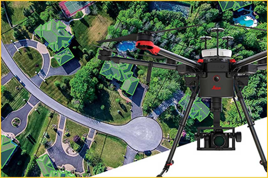
Emitech Infosystems conduct DGPS, Total Station and Aerial surveys on all types of topography. The survey data is used for digitizing cadastral maps, visualizing land features, identifying obstacles etc. Once the surveyed data is mapped, it provides valuable spatial information that can be used for project planning, risk analysis, monitoring environmental impacts of particular operations etc. This data is also integrated into the GIS application that acts as a decision-support system. Our experienced team of surveyors ensures a high-degree of detail and accuracy in their procedures for maximum effectiveness.

MOBILE APPLICATION DEVELOPMENT

MOBILE APP DEVELOPMENT

Emitech Infosystems has established expertise in the domain of enterprise mobile apps development with teams in IOS and Android. Emitech Android & IoS App Development team has core expertise in developing enterprise application. It has developed application ranging from data collection using text, photographs and videos to applications extensively using geographic locations with capabilities to integrate it with existing maps like Google, Bing, Open street map etc.

0
0
0
0

Products

Imajing

Imajing

Imajing has been designing geospatial data collection and data processing technologies to serve needs of transportation infrastructure managers, smart cities and engineering or construction companies. Ease of use, cost efficiency, productivity and a wide range of tools have been at the heart of our concept ever since the beginning.Our technology is bringing solutions to capture, produce, structure and share geospatial information in order to map, inventory, monitor or control any linear infrastructure and all its assets. Today, our toolchain is used all around the world by engineering companies, local authorities and road & railway infrastructure owners.

ESRI ArcGIS Software

ArcGIS is a system that lets you easily author data, maps, globes, and models on the desktop and enterprise to serve them out for use on a  desktop & Enterprise level, in a browser, or in the field via mobile devices, depending on the needs of your organization. If you are a developer, ArcGIS gives you tools for building your own applications. ESRI Inc. is the world leader in GIS Mapping and Solutions and produces and markets the most-widely used and globally famous ArcGIS suite of software.

Trimble

Trimble Inc. is a Sunnyvale, California-based developer of [Global Navigation Satellite System] (GNSS) receivers, laser rangefinders, unmanned aerial vehicles (UAVs), inertial navigation systems and software processing tools.  Trimble Geospatial provides solutions that allow you to make your mark using high-quality, productive workflows and information exchange, driving value for a global and diverse customer base of surveyors, engineering, and GIS service companies, governments, utilities, and transportation authorities. Trimble’s innovative technologies include integrated sensors, field applications, real-time communications, and office software for processing, modeling, and data analytics.