Law Enforcement
Analyze and understand incident trends; collaborate with other agencies; and allocate resources effectively to protect human life and property.
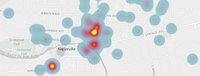
Create Incident Maps
Public Safety Incident Maps can be used by law enforcement agencies to create a series of incident layers from computer aided dispatch or records management data.
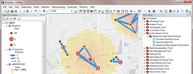
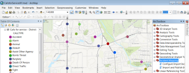
Create Crime Predictions
Repeat and Near Repeat Analysis can be used by law enforcement agencies to identify repeat and near repeat victimization patterns of a particular crime type within a specified time frame and geographic area.
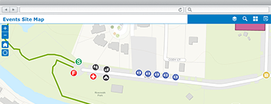
Manage Community Events
A collection of maps and apps used by government agencies and other stakeholders to permit, coordinate, plan, and promote community or special events.
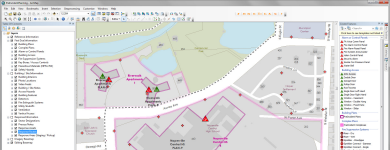
Develop Pre-Incident Plans
Pre-Incident Planning can be used by fire and law enforcement incident operations personnel to streamline the collection of hazards, equipment, supplies, and procedures needed to deal with a potential incident.
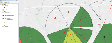
Analyze Cell Phone Data
Cell Phone Analysis can be used by law enforcement agencies to analyze cell tower information and call detail records acquired from wireless service providers.
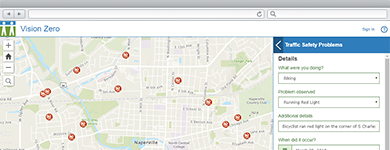
Identify Transportation Hazards
A collection of maps used to identify transportation hazards and dangerous traffic behaviors that could lead to fatalities or serious injury on a roadway.
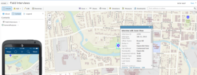
Conduct Field Interviews
Field Interview can be used by law enforcement officers to collect field interview cards and field contact reports.
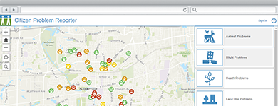
Submit Requests for Service
Citizen Problem Reporter can be used by the general public to submit non-emergency problems or requests for service in their community from a smartphone, tablet, and desktop computer.
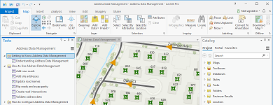
Manage Address Information
A collection of maps used to manage road centerlines, site addresses, facilities, mailing addresses, and aggregate this information from authoritative sources for use by state and regional agencies.
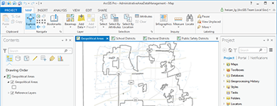
Inventory Administrative Areas
Administrative Area Data Management can be used by mapping technicians to maintain an inventory of geopolitical areas, school districts, voting precincts, public safety districts, and service boundaries.