Planning and Development

Engage the community in your growth management plans, promote business diversity, attract talented citizens, and encourage quality places and environments.
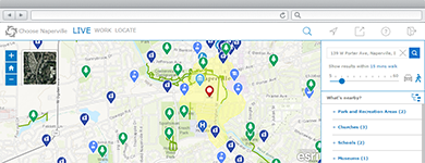
Promote Vibrant Economies
A collection of maps and apps used by the general public and businesses to explore quality of life characteristics, locate available sites, and discover potential incentives.
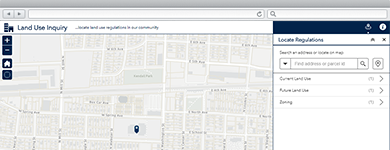
Encourage Orderly Growth
A collection of maps and apps used by the general public and developers to identify land use, zoning, and other regulations that impact the use of land.
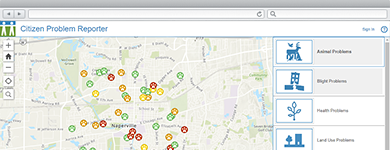
Transform Blighted Properties
A collection of maps and apps used by planning staff to understand the scope of blight issues in their community, acquire and maintain problem properties, and return properties to productive use.
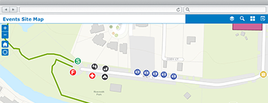
Manage Community Events
A collection of maps and apps used by government agencies and other stakeholders to permit, coordinate, plan, and promote community or special events.
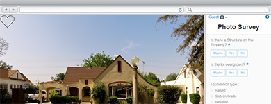
Photo Inventory Properties
Photo Survey can be used by local governments to publish street-level photo collections and conduct focused property surveys that may identify blight, damaged structures, or construction activity.
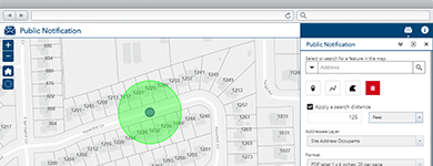
Notify Property Owners
Public Notification can be used by local government staff to identify a collection of properties and create mailing labels, or a structured text file, of owners and occupants.
Connect with Citizens
A collection of maps and apps used by the general public to review land use cases and submit feedback, locate a park or school, and submit requests for service in their community.
Manage Code Violations
Code Violation can be used by code enforcement officers, building officials, and zoning administrators to collect violation and related inspection information.
Publish 3D Scenes
A collection of local government 3D scenes that serve as a foundation for desktop, mobile and web mapping applications.
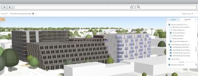
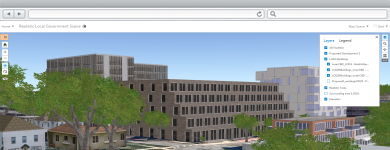
Review Proposed Developments
Review Proposed Developments can used by local government staff to visualize proposed developments and assess the impact of each development on the existing community.
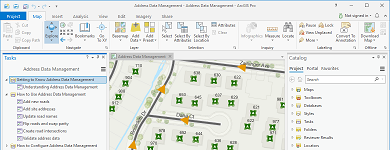
Manage Address Information
A collection of maps used to manage road centerlines, site addresses, facilities, mailing addresses, and aggregate this information from authoritative sources for use by state and regional agencies.
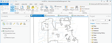
Inventory Administrative Areas
Administrative Area Data Management can be used by mapping technicians to maintain an inventory of geopolitical areas, school districts, voting precincts, public safety districts, and service boundaries.