Preparedness
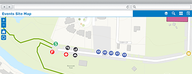
Manage Community Events
A collection of maps and apps used by government agencies and other stakeholders to permit, coordinate, plan, and promote community or special events.
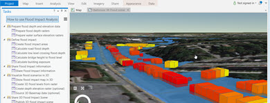
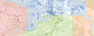
Develop Flood Response Plans
The Flood Planning map can be used by emergency management personnel to analyze the impact of seasonal flooding scenarios and develop flood response plans.

Emergency Assistance
The Emergency Assistance application can be used by citizens to provide emergency management organizations with pertinent information about themselves in order to ensure their safety during an emergency incident.

Share Evacuation Zones
The Evacuation Zones application can be used by emergency management organizations to enable the public to determine when evacuations are required.
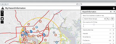
Increase Preparedness
The My Hazard Information application helps residents discover hazards that exist in their community and obtain information about evacuation routes and government facilities.
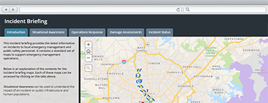
Brief Incident Personnel
The Incident Briefing application can be used by emergency management personnel to provide map-based briefings and reports during incident and blue sky conditions.
Aggregate Parcel Information
Community Parcels can be used by organizations to aggregate authoritative parcel data and deliver focused parcel maps to key stakeholders.
Aggregate Address Information
Community Addresses can be used by organizations to aggregate authoritative address data and deliver focused maps and locators to key stakeholders.
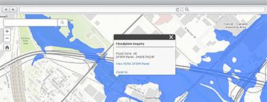
Identify Flood Risks
The Floodplain Inquiry application can be used by citizens, land development companies, and real estate professionals to locate parcels impacted by FEMA floodplain boundaries.
Import CAMEO data
Help prepare for and respond to chemical emergencies by importing data from a CAMEO system into a File Geodatabase for further GIS analysis.