Public Works
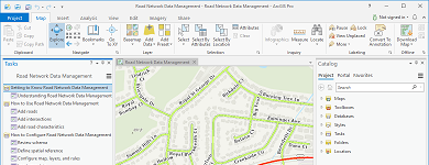
Maintain Public Road Network
A collection of maps used by public works staff to manage the public road network, road characteristics, service boundaries, and associated maintenance agreements.
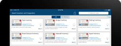
Inventory Right of Way Assets
A collection of maps used by field staff to inventory signs, signals, streetlights, and other visible assets in the public right of way.
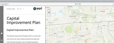
Maximize Capital Investments
A collection of maps and apps used by public works staff to define capital projects, coordinate project schedules, track project performance, and share project status with key stakeholders and the general public.
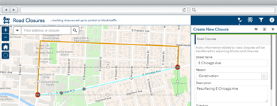
Communicate Road Closures
Road Closures can be used by engineering and operations staff to maintain an inventory of road closures, and communicate closures and detours to travelers.
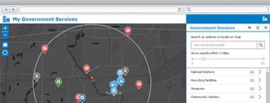
Connect with Citizens
A collection of maps used by the general public to locate parks, obtain information about public works services, comment on proposed projects, and submit requests for service in their community.
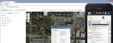
Promote Public Parking
Public Parking can be used by parking staff to inventory parking assets and promote public parking alternatives in their community.
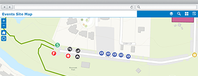
Manage Community Events
A collection of maps and apps used by government agencies and other stakeholders to permit, coordinate, plan, and promote community or special events.
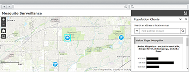
Manage Mosquito Populations
A collection of maps and apps used by public works or mosquito control agencies to manage mosquito populations and the spread of vector-borne diseases.
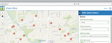
Identify Transportation Hazards
A collection of maps used to identify transportation hazards and dangerous traffic behaviors that could lead to fatalities or serious injury on a roadway.
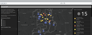
Manage Snow Operations
SnowCOP can be used by operations managers to monitor snow event responses and determine which streets are not getting attention.
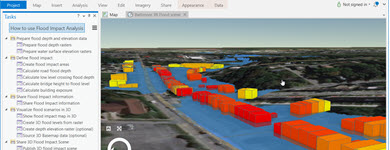
Develop Flood Response Plans
Flood Planning can be used by emergency management personnel to analyze the impact of seasonal flooding scenarios and develop flood response plans.
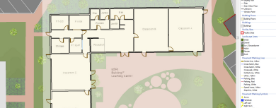
Maintain Facilities and Grounds
A collection of maps and apps used by public works staff to maintain facilities and grounds on a campus or a single building.