Response

Situational Awareness
A collection of maps and apps used by emergency management and public safety personnel to maintain situational awareness when preparing for, and responding to, an incident or event.

Summarize Impact
The Impact Summary Map can be used by emergency management organizations to quickly communicate impact of an event to interested parties. It utilizes enriched content to facilitate quick summary information for the affected population.
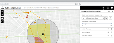
Public Information Map
The Public Information Map can be used by emergency management organizations to communicate event based information with various stakeholders and constituents.
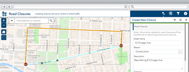
Communicate Road Closures
The Road Closures map can be used by emergency management staff to maintain an inventory of road closures and communicate closures and detours to travelers.
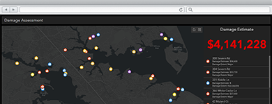
Conduct Damage Assessments
The Damage Assessment application can be used by inspectors to conduct structural damage assessments in a connected or disconnected network environment.
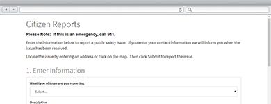
Report Health and Safety Issues
A collection of maps and apps used by citizens and public safety personnel to file reports important to the health and safety of a community.

Locate Emergency Shelters
The Shelter Locator enables citizens to find emergency shelters near them when evacuating from a natural or man-made incident.

Share Evacuation Zones
The Evacuation Zones application can be used by emergency management organizations to enable the public to determine when evacuations are required.
Import CAMEO data
Help prepare for and respond to chemical emergencies by importing data from a CAMEO system into a File Geodatabase for further GIS analysis.
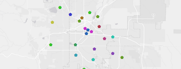
Produce Emergency Maps
The Emergency Management Maps can be used by mapping technicians to create a standard set of briefing and response maps.

Perform Photo Surveys
Photo Survey can be used by emergency response organizations to conduct surveys that identify damaged structures.
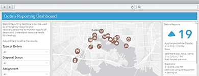
Report Locations of Debris
Debris Reporting supports Emergency Response organizations with determining the location of remaining debris by enabling the public and response workers with tools to report where debris is.
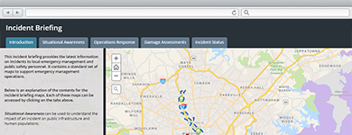
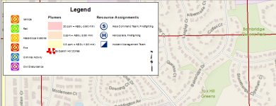
Brief Incident Personnel
The Incident Briefing application can be used by emergency management personnel to provide map-based briefings and reports during incident and blue sky conditions.